New walk-in access opens on Turtle
Partnership creates launch for canoes, kayaks that connects to Cedar River State Water Trail
AUSTIN, Minn. — July 19, 2022 — For years, locals have paddled the meandering route of Turtle Creek on Austin’s west side to enjoy the stream in the city and use it as a connection to the Cedar River State Water Trail.
Easy access for launching a canoe or kayak on the creek, however, has been a challenge.
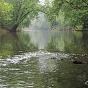
Thanks to a multi-agency partnership that started two years ago, the public now has a walk-in access in Austin for launching canoes and kayaks on Turtle Creek to float downstream to the Cedar River or paddle upstream to enjoy the wooded hillsides on the city’s west side.
Officials from the partnering groups gathered today (Tuesday) at the new rock-surface access and large parking area now available on the northwest side of the 12th Street Southwest (MN Hwy. 105) bridge over Turtle Creek.
Turtle Creek Watershed District funded up to $2,750 for the access; Austin Area Foundation awarded a $2,000 grant to the Cedar River Watershed District; the City of Austin designed the access and delivered rock materials; and the Minnesota Department of Natural Resources built the access July 13.
“We are constantly looking at ways to enhance the local waterways and connect the public to them, and this is a great, collaborative project toward those goals,” said Tim Ruzek, CRWD’s water plan and outreach coordinator.
Mower Soil & Water Conservation staff perform the work of both the Cedar River and Turtle Creek watershed districts.
MN DNR area parks and trails supervisor Joel Wagar agreed to devote a crew to the access construction because paddlers have been using it as a route to the Cedar River and then down to the DNR’s Riverwood Landing south of Austin.
DNR built a sloped, rock-covered access into the creek to provide an easier, safe and less-muddy launch onto the water. DNR also placed large pieces of rock on both sides of the access to protect it from washing out in floods.
This 1.5-acre, former residential property at site at 1206 12th Dr. S.W. was acquired a year ago by the City of Austin through its flood-mitigation program, which removed a home and two garages. A half-acre of woods owned by the city is next to it.
Turtle Creek Watershed District board member Jon Erichson, of Austin, said the new access is part of the watershed district’s goal to provide more opportunities for area residents to enjoy the local waterways.
“As someone who lives close to Turtle Creek, I have found that this stream is underutilized by the public,” Erichson said. “Our family will put our kayaks in across from our house, which has never been convenient, but the enjoyment has always been worthwhile.”
Paddling Turtle Creek to the Cedar River, that stretch has “always felt like we are on a stream in northern Minnesota,” Erichson said.
Signage is planned for the access later this year to help paddlers find the site while also promoting local water recreation to the thousands of motorists who drive over the 12th Street bridge every day.
“Anytime we can add more accessibility to our waterways should be celebrated, and the Austin Area Foundatoin is proud to have helped add this access for the community,” said Taggert Medgaarden, chair of the foundation’s board of directors.
Five years ago, a similar partnership of CRWD, MN DNR, City of Austin and Austin Area Foundation created a rock-surface access behind Austin’s Marcusen Park baseball stadium on the Cedar River State Water Trail in Lafayette Park.
Plans began in 2020 for the Turtle Creek access, with the CRWD reaching out to partners for the project. Originally, the access was planned for construction in 2021 at another flood-mitigation site owned by the city on the southeast side of the 12th Street Southwest bridge. But plans changed a year ago when the city was able to acquire property across the road.
This change, Ruzek said, provided a better site for the access in terms of visibility, space, parking surface and spot for launching canoes and kayaks. The access is upstream from a few sets of riffles and where the creek splits in two so paddlers can decide whether to paddle downstream or upstream, he said.
Turtle Creek’s new access is one mile upstream from its confluence with the Cedar River, just east of Calvary Cemetery. From there, paddlers can float another 2.5 miles on the Cedar to the Riverwood Landing — owned and maintained by the Minnesota Department of Natural Resources — near the Solafide Observatory in Austin Township.
Heading upstream — which shouldn’t be too challenging with flow most times of the year — is more than two miles of paddling on Austin’s west side upstream to the Interstate 90 bridges over Turtle Creek. Some locals also have paddled Turtle Creek from the small Freeborn County town of Moscow into Austin, which is about eight river miles to the new access.
