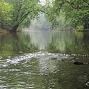
Major grant awarded to watershed district for Dobbins
Water-quality projects planned in creek’s north branch for construction in early 2024
Feb. 3, 2023
Over the past century, heavy rains have caused Dobbins Creek to rise and fall quickly on its way toward Austin, leading the stream to overtop rural roads and cause major erosion.
This history of damaging flash floods has disconnected Dobbins Creek from parts of its natural floodplains, causing the stream to flow even more strongly after heavy rains. This causes erosion on streambanks that accounts for nearly half of the sediment found in the waters of Dobbins Creek, which flows through Austin’s Jay C. Hormel Nature Center and East Side Lake.
Thanks to a $395,000 state grant awarded to the Cedar River Watershed District, restoration is being planned for more than a half mile of Dobbins’ north branch, southeast of Brownsdale, to reconnect the stream to its flood plain and address erosive areas. This work, in turn, will improve the creek’s habitat for wet bugs and fish.
“We’re grateful for this significant grant and excited to tackle more problematic areas in the Dobbins watershed,” said Cody Fox, CRWD’s administrator and project manager.
This Conservation Partners Legacy (CPL) grant was awarded through the Minnesota Department of Natural Resources. Under the grant, CRWD will focus restoration in early 2024 on Dobbins’ north branch flowing through the Gene and Bridget Tapp farm in Dexter Township. The district is working with engineers, the DNR and Tapps to develop plans.
“It’s very clear this stretch of Dobbins needs help to stabilize itself and become a healthier stream,” Fox said.
Macroinvertebrates or “wet bugs” and fish are important because they live in and around the water all year and can provide vital information on a stream’s overall health, Fox said.
“The creek’s water quality needs to be good for most of the year for wet bugs and fish to survive,” Fox said, adding that Dobbins’ north branch is listed by the state as “impaired” for turbidity or the cloudiness of the water, which is caused by sediment from fields and streambank erosion.
This is the second, major restoration on the Tapp farm for Dobbins. Several years ago, the first restoration involved similar work along an upstream stretch of Dobbins. When this next phase is completed, nearly 1.3 miles of the creek will have had restoration work.
Work next year will seek to create pools and rock riffles in the creek channel to support better habitat for fish and wetbugs. Crews also will plant and manage plants along the creek, reshape streambanks, clear out tree blockages that cause erosion and place chunks of rocks in highly erosive spots.
Problematic trees on the streambank also will be removed where vegetation is lacking, leading to streambank erosion. Some of the trees will be drilled into the streambank with the root ball sticking out for streambank protection.
This project is part of the CRWD’s large-scale, ongoing mission to improve Dobbins Creek’s water quality and reduce its stormwater flows, Fox said. The district continues to focus projects in Dobbins, he said, because studies show the creek plays a big role in local flooding and water-quality concerns.
According to a 1990 study, sedimentation levels in East Side Lake at the time mostly ranged from 2 feet to nearly 6 feet of sediment buildup, with higher amounts found closer to the lake’s dam on Dobbins Creek. Since that study, the lake has experienced six of the seven worst-known floods in Austin, adding more sediment.
The Tapps were honored in 2019 as Mower County’s Outstanding Conservationists of the Year as decided by the Mower Soil & Water Conservation District’s Board of Supervisors. Mower SWCD staff perform the work of the watershed district.
Over the years, the Tapps have worked with Mower SWCD and CRWD to install grassed waterways in crop fields, build earthen embankments to control stormwater, enroll cropland into native prairie and stabilize streambanks on Dobbins. They also have done no-till soybeans that does causes minimal soil disturbance during planting.
“We are very fortunate,” Fox said, “to have a strong, ongoing partnership with the Tapps to continue doing good projects on their land.”
