LOOKBACK: Ski club once offered at Austin’s ‘Alps” along Turtle Creek
Hilly area once referred to as Crestwood Hills known today as Nob Hill with section still owned by city for sledding in SW Austin

“It had to happen. The ski bug has even invaded Austin,” proclaimed an article on Jan. 5, 1955, in the Austin Daily Herald.
At that time, the City of Austin was starting a ski school at the hilly area along Turtle Creek’s west side at an area known as Crestwood Hills, which then began getting referred to as “Crestwood Alps.”
This land today now is within Austin’s city limits in an area known as Nob Hill, which still includes a city owned hill overlooking Turtle Creek that continues to be used for sledding.

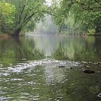
Traveling to Crestwood Hills from Austin back then involved traveling west on State Hwy. 16 (Oakland Avenue) over Turtle Creek and taking the first left turn at the top of the hill onto Crestwood Hill Road.
Back in the 1950s, downhill skiing was America’s “fastest-growing winter sport” that seemed destined to bypass the Austin area’s “flatland,” according to the Herald article.

“At any rate, Austin youngsters and adults alike are careening down the few available hills and, in general, are experiencing a rather rude and bruising introduction to the ‘white art,’ ” the article says.
To keep a flood of broken arms and legs from coming into Austin’s St. Olaf Hospital, Austin’s Recreation Department decided to offer ski lessons.
“There’s a definite interest in skiing among Austin’s young people to start an organized ski school,” said Harry Strong, who was the city recreational director at the time. “We want to prevent as many accidents as possible and still teach the skills needed to fully enjoy this thrilling sport.”
The city’s recreation board arranged to use the Crestwood Hills area — which was outside of the city limits at the time — as a site for the ski school program. The department hired a skiing instructor and planned a full program for beginning skiers.
Classes were open to all high school and college students as well as young adults. Classes were offered on weekends, with registrations accepted at the old Shaw Gym, which was located in what is today a parking lot just south of the city’s municipal pool.
“So save our forests,” Strong said in 1955. “Stop knocking our trees down. Enter the recreation department’s ski school and save the landscape.”

A few months after the ski lessons began, city construction crews started building a 64-foot “pontoon bridge” to serve the Crestwood area for the ski classes. Crews started constructing the bridge at the city warehouse to haul later in sections to assemble over Turtle Creek at the bottom of Nob Hill/Crestwood Hills area.
The “pontoon” bridge consisted of 16-foot sections with a plank deck and railings resting on old barrels that rested on the ice but could sit on the creek’s bottom when its levels were normal.
City officials planned to take out the bridge before the spring thaw each year.

Austin Township and Mower County officials first started considering residential plats for the Crestwood Hill area in 1954, leading to various development plats submitting in preceding years. Austin experienced significant residential and commercial growth to the west during the 1950s, including the Sterling Shopping Center and surrounding neighborhoods.