DNR seeks part of Ramsey Mill Pond
Mostly water-covered area would add 22.5 acres to state WMA
April 26, 2023
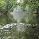
Much of Ramsey Mill Pond’s lake-shaped area north of Austin likely will become publicly owned by this summer as the state moves to acquire nearly 23 acres mostly covered by water.
On Tuesday, the Mower County Board unanimously approved a plan for the Minnesota Department of Natural Resources (DNR) to finalize the purchase of 22.5 acres — mostly covered by the Cedar River State Water Trail — in Lansing Township from Ramsey Golf Club, Inc. This business used to operate the Ramsey Golf Course across the river from The Old Mill Restaurant and Ramsey Dam.
County board approval was necessary for the transaction of private land to public ownership.
With a finalized purchase expected this summer, the acres would become part of the DNR’s 395-acre Ramsey Mill Pond Wildlife Management Area (WMA) that borders the acquisition area to the south, east and north. On the south side, it borders the DNR’s Wild Indigo Scientific Natural Area (SNA) trail where its western end starts.
The WMA is named after Ramsey Mill Pond, a mile-long stretch of the Cedar River behind Ramsey Dam that covers about 53 water acres. It is Mower County’s largest waterbody.
Property involved in the acquisition consists of shallow water, marsh, floodplain and a small area of upland forest. Joining the state’s WMA will help with the conservation of wetlands, shoreland and wildlife dependent on these habitats, said Jeanine Vorland, a DNR area wildlife manager who oversees the Ramsey Mill Pond WMA. Throughout Minnesota, WMAs are used for “dispersed, wildlife-based recreation,” such as birdwatching, hunting, trapping and fishing.
While the state doesn’t pay property taxes on WMA land, the state will make annual “payment in lieu of taxes” to Mower County equal to three-fourths of 1 percent of the property’s value, Vorland said.
Overall, Ramsey Mill Pond WMA would total nearly 418 acres after the acquisition. One of 14 WMAs in Mower County, the Ramsey WMA would remain the county’s second-largest WMA behind the 480-acre Cartney WMA, north of LeRoy.
Access to the Ramsey Mill Pond WMA includes a gravel road on its east side off Mower County 61, about three miles north of Austin’s Jay C. Hormel Nature Center. From that parking area, a walking trail leads to the river. Another parking area is off 260th Street on the WMA’s west side, just south of the village of Lansing.
Ramsey Mill Pond is created by Ramsey Dam since about 1872 when the first version of the dam was built to power a flour mill that operated until 1933. From 1949 through the present, that mill property has been The Old Mill Restaurant.
Just southwest of the acquisition area is a 23-acre parcel of land almost entirely owned by Mower County along the river’s west side. In 2017, Mower County acquired about 20 acres of flood-prone land from Ramsey Dam to an abandoned 1911 rail bridge.
The Hormel Foundation and DNR funded that acquisition, which involved the removal of storage sheds and a home repeatedly damaged by floods. That purchase included the old rail bridge’s western half as its eastern half already was owned by DNR for the western end of the Wild Indigo SNA trail.
DNR also owns a small parcel at the Ramsey Dam, where it maintains a boat ramp, safety buoy on the river and parking area.
After the Austin area’s worst-known flooding in September 2004, the state and county acquired some of the land next to Ramsey Dam through flood mitigation, including the former Ramsey golf clubhouse that overlooked the dam and Old Mill. Prior to the golf course, that north/west side of the river at Ramsey served as a public park, where people came to fish, picnic, swim, boat and camp.
In December, Hormel Foods Corp., which has owned Ramsey Dam since 1974, paid a contractor to strengthen the dam’s foundations to slow the structure’s deterioration. This included crews removing trees and adding chunks of rock or “riprap” to both sides of the dam and below it. They also filled a large scour hole and addressed streambank erosion.
During the week of May 8–12, Ramsey Mill Pond again will be the site of the Canoemobile programming offered by the nonprofit Wilderness Inquiry in partnership with Cedar River Watershed District.
This will be the fifth offering of Canoemobile, which consists of six, 10-person canoes guided by a trained staffer as they paddle upstream and back above Ramsey Dam. Land-based programming also is done with students on the county’s property at Ramsey.
Each public and private school in Mower County, along with Blooming Prairie and Hayfield schools, take part in Canoemobile. All Austin fourth-graders come to Canoemobile, which led 761 paddlers (mostly children) over five days on Ramsey Mill Pond.
